Day 5- June 5th
The start of the Appalachian mountains! The highest elevation we came to was 3,295 feet…and that was a struggle. Luckily, we split the mountain into two parts; however, part one was the most rigorous as it was the whole climb to the 3,000 feet elevation range.
Leaving Charlottesville, we encountered some hills. Our original plan was to stay in Afton, about 35 miles and tackle the mountain the next day. In Afton, there use to be a lady- June Curry aka “the Cookie Lady”- who would give shelter, a shower, and food to bikers as they pass her house that’s on the trail. We were going to stay there, but when we saw it, it looked abandoned and not well-kept.
For those looking to do this section of the trail and want to find/stay at the house. It’s by the Post Office. Going West- past the post office up the hill for several feet on the right. Going East- right before the post office on the left as you go down the hill into town.
Getting to Afton was super steep. It was a long hike. Around 3 miles of straight up. After Afton was no different.
We eventually made it to the Blue Ridge Parkway. This road goes along the mountains across several states.
Here is where all the mountain climbing happened. About 16 miles in we came across a visitor center and stopped for water, the restroom, and directions to the campground we were looking for (another 10 miles). We proceeded to go 5 miles…STRAIGHT UP HILL. It was the worse climb. As we neared to a plateau (not to the top, oh no), it started to rain. We scurried to get our rain jackets, bags over our seats, and strap everything down.
“Welcome to bike touring.” Dad said. We were struggling on the side of the road for about 10 minutes and then it downpoured.
We proceeded to go up some more hills, not as bad as before, but still stressful. Finally, we reached the campground as the rain stopped. We pitched our tent next to our New Zealand couple friends. The accommodations were sparse. Water was from a spicket and there was a portable outhouse. We quickly set up the tent and arranged our bags inside our rain flap before it started raining again. Luckily, our bags are water proof.
Yes, it was a tiresome and upsetting climb, especially with the rain, but, I got to hand it to nature, the views were amazing.
We did meet a nice gentleman on route who was doing his daily bike ride. He told us of a nice place to grab lunch- Chiles Peach Orchid Farm. They had delicious peaches and strawberries along with other goodies like peah cider donuts.
If you are doing the trail, definitely stop in. It’s along route, highway 810, around Crozet/White Hall area.
We also had our first dog chase. However, his heart wasn’t really into it as he was a significant amount behind us and didn’t follow us very long.
In total, we rode 46.7 miles from Charlottesville to Love, VA.
Day 6- June 6th
The next morning, at the camp site, I met a woman hiking the Appalachian trail (AT)-that’s pretty awesome.
We had a bit of a climb, but not as bad as the day before. Going to the campground, in Love, westbound, is the worse part of the mountain. The second half was not bad. The second part of the Appalachian mountains looks to be easier as well, but we will see in a few days.
Westbound at this point is quite easy, but also nerve wracking. It is a steep descent for 4 miles with lots of curves. Since the curves are tight, we had to be careful with the cars.
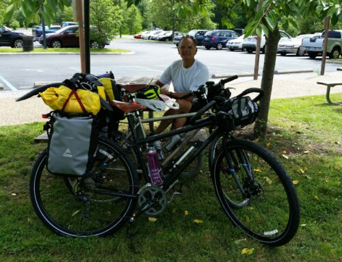
Of course, Dad would get a flat tire and it would be the back one. So we had to remove all his gear, replace the tube, and then put everything back on.
After a 15 minute ordeal, which included my bike falling down from it leaning against a sign and the gear chain coming out, we proceeded back down the hill.
If you are going East, prepare yourself for this climb- it is steep and the road is tight with curves. Definitely make yourself more obvious to the cars.
We eventually made it to Vesuvius where we then we’re directed to Gertie’s. A part convenience store, part thrift store, part restaurant. It was really cool.
We deided to eat lunch or brunch there and ordered a BBQ sandwich, which is what they are known for, and it was amazing!
The building has been there since the 1940s and the current owner has owned it for 18 years. Gertie is her mom. The walls are full of names and messages. We included ours.
Westbound, turn right after the train tracks and it’s on the right hand side. Going East, continue straight past the tracks and it will be on the right side. It’s about .5 miles off route.
The next 14 miles was flat as it followed the river. We met a woman cycling from her home near Vesuvius to Blacksburg, which she said was 110 miles one way. She planned on making it a round trip in one day. Blacksburg is a bit East of our destination of Christiansburg. However, we don’t plan on arriving there until Wednesday (the 8th). She was doing a round trip in a day! We were both impressed as she told us she did the transamerica route before and just did a half marathon a couple of days ago.
We then came into Lexington, VA, 36.14 miles later (from Love). This is the home and burial place of Stonewall Jackson. We stopped in the bike shop- the owner was quite helpful. Virginia Military Institute is also here. The town holds about 7,000 people and it’s really nice.


You two are looking good, worried a bit for you Greg, flat rear tire must of tired you out. or BBQ sandwich made you very content and full. great pic’s. Happy Trails.
Ya, everything is good! Trying to get a handle on the tire- more flats, will put in next post